Cuvelai-Etosha Basin, Namibia
The Cuvelai-Etosha Basin (CEB) is a transboundary endorheic surface watershed shared almost equally by Angola and Namibia with a total size of 173,000 km². The Cuvelai-Etosha region is home to a large number of people both on the Namibian and Angolan sides, mainly because of the presence of shallow groundwater and relatively fertile soils in many areas . The basin has a vivid hydrogeological history as both the deltas of the Cunene and Okavango Rivers were once situated within the CEB . In recent history, a deep aquifer containing fresh water was discovered in the northeastern part of the basin. At present all of the surface water is either draining towards the Etosha Pan, a salt pan located in the southern part of the CEB or remains in surface depressions (locally called iishana) that are forming a vast, partly inter-connected channel-like system north-west of the Etosha Pan.
No perennial river exists, and the basin receives all of its water concentrated over the rainy season from November to April. Mean annual precipitation varies between 200 and 600mm y−1 along a distinct rainfall gradient from the south-west to the north-east of the basin (Fig. 1). In the years 2014 and 2015 a major drought due to exceptionally low rainfall occurred throughout southern Africa causing many surface water reservoirs to dry out and water consumption to be limited in many places. Temperature average throughout the basin is 22°C with maximum values reaching up to 40°C in summer. In winter, temperatures can drop below zero at night. Potential evaporation rates can reach up to 3000 mm y−1 and exceed yearly rainfall by a factor of five.
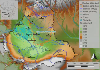
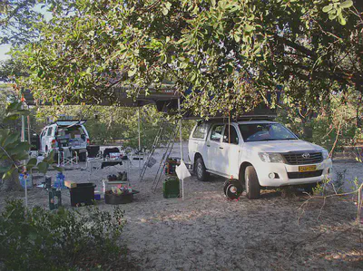
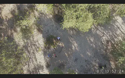
Between 2013 and 2016 several field campaigns were carried out with the goal to improve the understanding of groundwater recharge related processes in the Eastern Sand Zone . Extensive sampling (soil water isotope depth profiles, bulk isotope precipitation, bulk soil, xylem) took place and continuous monitoring of key variables (soil water content, matric potential, precipitation, meteorological information) was established at sites with differing soil types, geology, vegetative cover and geomorphology. Elundu Forest Site is situated approximately 20 km east of the township Eenhana. A number of studies on groundwater recharge estimation, hydrogeochemical characterization , root water uptake and water balance estimations using isotope data have been carried out here previously.
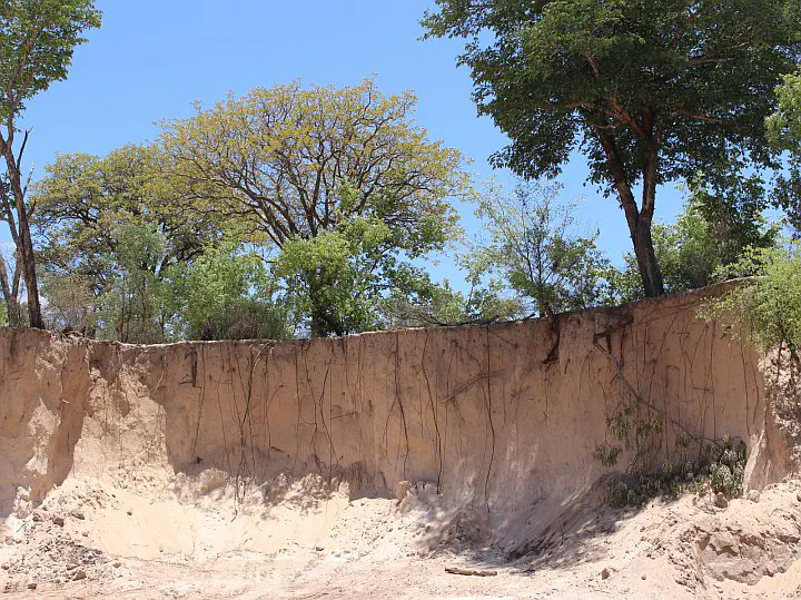
The site is classified as a medium-dense forest underlain by thick Kalahari sheet sand which is characteristic for the Eastern Sand Zone. The Kalahari sands in this area are classified as fine-grained medium sand which are highly permeable (saturated hydraulic conductivity ~2,400cm d-1) and homogeneous with depth. Groundwater at this site is located deeper than 20 m below ground and contains brackish water. In this part of the Eastern Sand Zone, the perched, hanging aquifers commonly found in the region are not present. The local vegetation consists of numerous large (heights greater 10 m) individuals of B. plurijuga, A. erioloba, C. collinum) as well as smaller trees (T. sericea, Burkea africana, Ochna pulchra, Erythrophleum africanum) and shrubs (mainly S. luebertii). Grasses are only present in the rainy season and generally have a low density due to livestock grazing. In terms of research on deep roots, especially the Acacias are of interest. Acacia erioloba has been shown to be capable of tapping very deep down (up to 50 m). Further, hydraulic redistribution is a common strategy of this species.
